Draft Enhanced Annual Plan 2024/25
Council's Draft Enhanced Annual Plan 2024/25 is out for consultation, and your input is crucial as we navigate the planning process for our district's future.
The Enhanced Annual Plan 2024/25 is a one-year plan and part of a longer-term planning process. It serves as a concise overview of our proposed services, activities, and financial strategies for the forthcoming year.
As we present this draft plan, we invite you to share your thoughts, insights, and visions for Buller between 12 April and 20 May 2024 at 4:30pm.

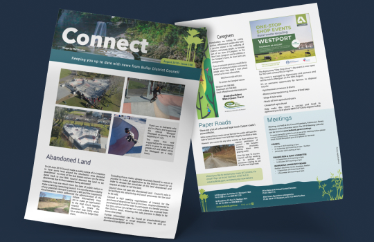
Connect is out NOW!
Plenty to read in our April edition!
This issue features Jamie's Mayor's message, Council's Enhanced Annual Plan, Buller’s new Cultural and Community Hub, a great story from our airport team, information about the proposed Zone one rubbish collection consultation, awesome news about Maruia School joining Enviroschools, and an update from our major projects like the Infrastructure Acceleration Fund and Resilient Westport.
Our newsletter is a great way to stay up to date with what Council is doing in our community.
How we’re shaping our district
Our goal is to promote the well-being of our local communities. We have a wide range of responsibilities under the Local Government Act. Local government affects you daily. We encourage you to get to know us and to find out more about how you can participate in local decision-making.


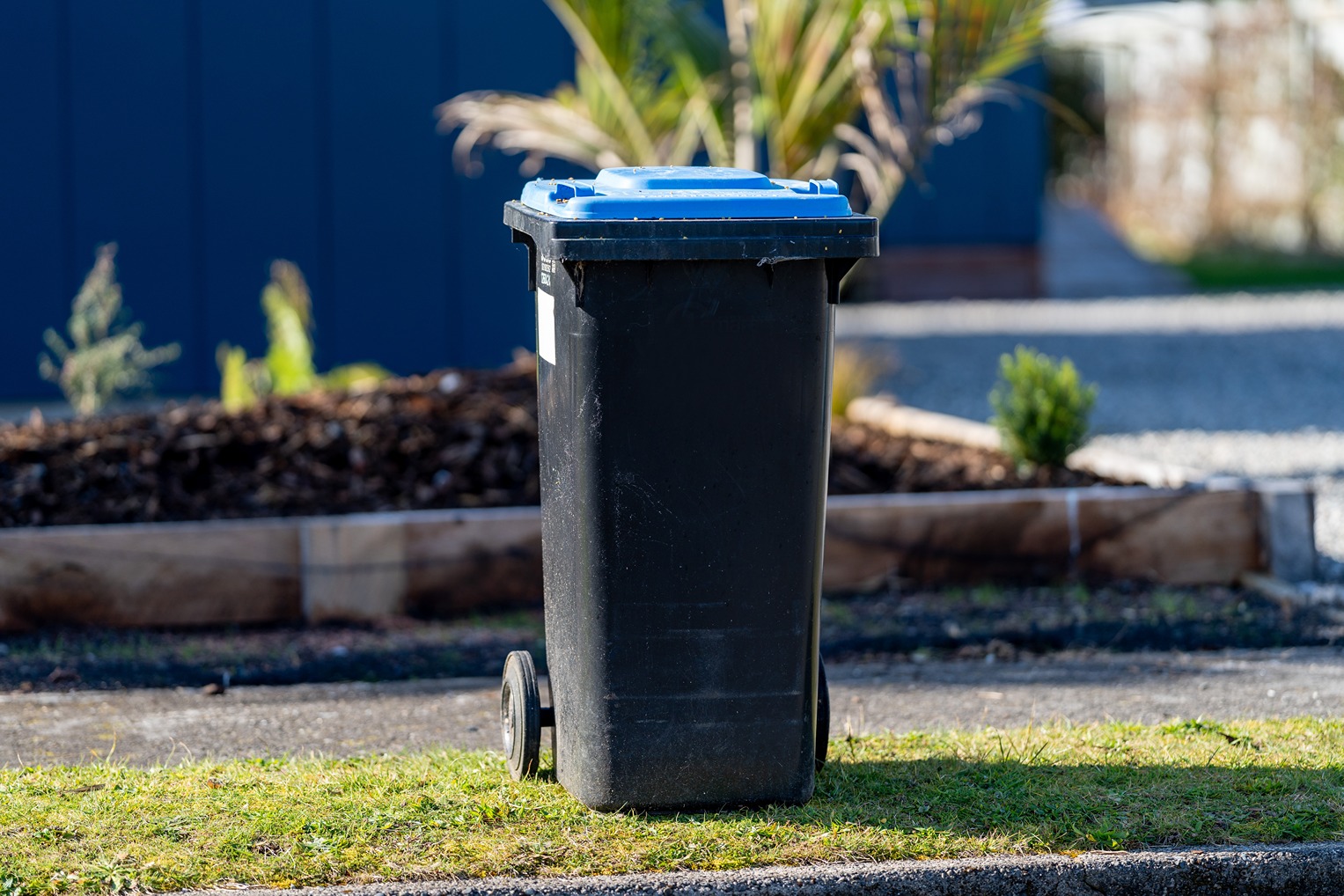
Zone one rubbish collection consultation
Council is proposing changes to the way that rubbish collection services are delivered and funded in Zone one from 1 July 2025.
There are four options to consider through this consultation:
- Option 1 - Status Quo - Private sector provides a weekly pre-paid bag and wheelie bin collection via Pay As You Throw.
- Option 2 - Private sector provides a fortnightly wheelie bin collection via Pay As You Throw.
- Option 3 - Council, through a private contractor provides a fortnightly wheelie bin collection with a single 120 litre bin size, Pay As You Throw.
- Option 4 - Council, through a private contractor provides a fortnightly wheelie bin collection with several different bin size options, i.e. 80 litres, 120 litres or 240 litres.
Get out and about in Buller
Our 8,574 square kilometers boasts two national parks, one forest park, and two heritage areas, all offering the opportunity to experience peace and tranquility or excitement and adventure. Our district is unbeatable in its diversity, and a great playground to work, live and explore.


Meetings and Mayor chats
Council's monthly meetings are open to the public unless there is reason to consider some items “public excluded”.
You can meet our Mayor, on a first come, first seen basis, during one of the regular Monday Mayor chats at the Clocktower Chambers, 9am - 12pm. Drop-in days in Reefton and Karamea are also available.
Need a good read ?
Our community newsletter Connect is always worth a look to stay up to date with what Council is doing in our community.
Connect is printed on a bi-monthly basis and delivered throughout the district.
You can sign up to our newsletter online and receive your issue straight and conveniently into your inbox.
Living in Buller
With an enviable climate, laid-back lifestyle, and friendly community vibe, the Buller district is a great place to live, work, and visit.
Buller has so much to offer. You will be surrounded by national parks, beautiful beaches, and an abundance of outdoor activities. The added bonus of never worrying about traffic or parking, leaves plenty of opportunity to get out and explore, creating exceptional work life balance.


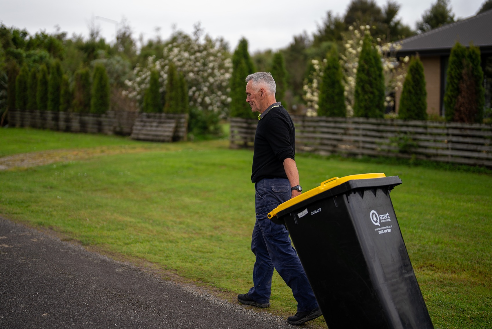
Request a recycling bin online!
Do you need a new glass crate, a replacement recycling bin, an additional wheelie bin to deal with your recycling, or did you moved into your new property and want to get your recycling containers?
Eligible properties in refuse and recycling zone one in Buller can request glass crates and recycling wheelie bins easily and conveniently through or online form.
Zone one covers Westport, the areas from Westport to the Mōkihinui Bridge, Westport to Punakaiki, Westport to Reefton including Blacks Point, and Reefton to Ikamatua.


