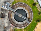
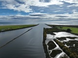
Wastewater from Westport and Carters Beach is processed in a treatment plant using an aerobic process before the treated wastewater is discharged into the Buller and Orowaiti River.
A key issue that Council is currently addressing is the mixing of wastewater and stormwater, which is an inherited historic problem in some parts of Westport. Before the Westport Wastewater Treatment Plant was established, wastewater and stormwater were often discharged to the same pipe. This is called a private cross-connection and allows stormwater to enter the wastewater network.
During dry weather, Westport's wastewater network and treatment plant operate efficiently and can cope with the volume of wastewater.
However, during medium and heavy rainfall events, the wastewater system is overwhelmed by stormwater through these private cross connections. The treatment plant can not cope with the large volume of stormwater and wastewater, causing it to overflow into the Buller and Orowaiti Rivers. These overflows are displayed on this page.
Currently, Council is renewing its resource consent with the West Coast Regional Council (WCRC) for Westport’s combined wastewater and stormwater overflows into the Buller River. Under the Resource Management Act, Council must have a resource consent to discharge treated wastewater into any river or other water body.
As part of the renewal process, WCRC requires Council to address the issue of these private cross-connections to reduce the frequency and volume of wastewater overflows into these two river systems.


