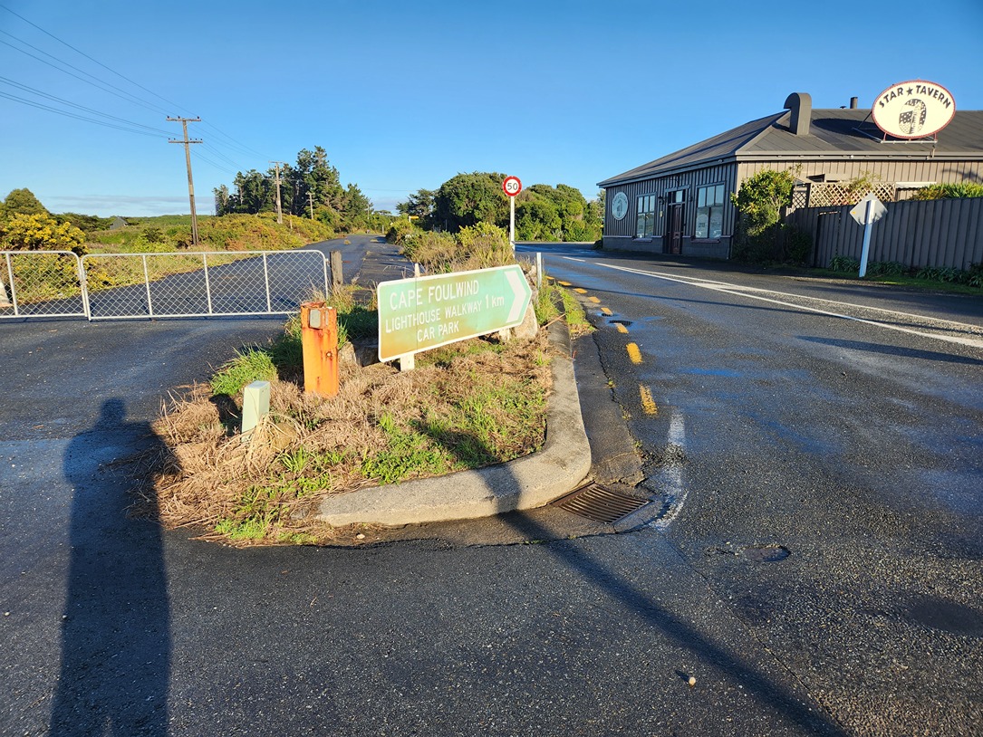
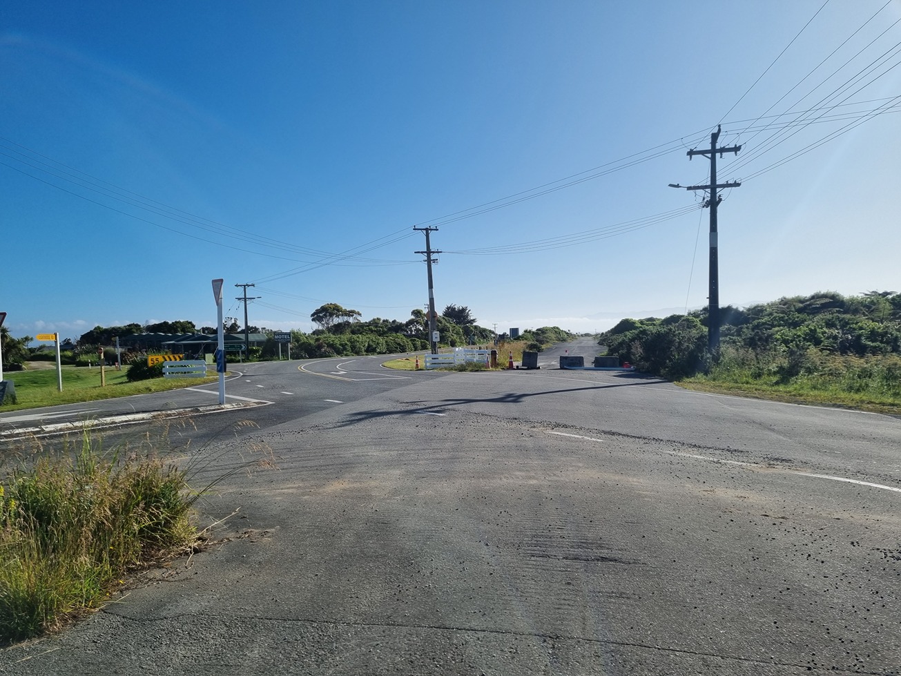
Council is investigating options for safety improvements at the Cape Foulwind Road/Tauranga Bay Road/Lighthouse Road intersection in Omau, about 12km west of Westport. Lighthouse Road provides access to the Cape Foulwind Walkway, while Tauranga Bay Road links to Tauranga Bay and the seal colony which is a popular tourist attraction. Limestone Road, which was used by Holcim when their quarry was active runs generally parallel with Cape Foulwind Road and Lighthouse Road, crossing through the intersection at a shallow angle.
Omau intersection safety upgrades
Kia ora koutou - welcome to the project page for the safety improvements proposed for the intersection of Omau, Lighthouse, Cape Foulwind, Tauranga Bay and Limestone Roads.
Project background
With the sale of Holcim's land and the Holcim haul road not being used for quarrying activities anymore, it has left an intersection layout at Omau which is not particularly fit for purpose nor easy to navigate for road users. The Cape Foulwind area and Omau is currently undergoing a period of investment and subdivision that requires Council to ensure that local road infrastructure remains appropriate.
Council is proposing to upgrade the Omau intersection due to safety concerns and to provide a safe alignment for the Kawatiri Coastal Trail.
Frequently Asked Questions
Read our frequently asked questions for further details about the project.
Why are these improvements necessary?
How did we identify the preferred upgrade option?
After an option assessment phase, two options were assessed for upgrading the intersection that included:
- Option 1 - Limestone Road has priority as a T-intersection with Tauranga Bay a Give Way
- Option 2 - Limestone Road joins to Tauranga Bay Road with Lighthouse Road remaining a Give Way
A traffic safety assessment was undertaken by independent peer review, and it was recommended that Option 2 is the preferred option as it will create the safest road set up.
What does this option involve?
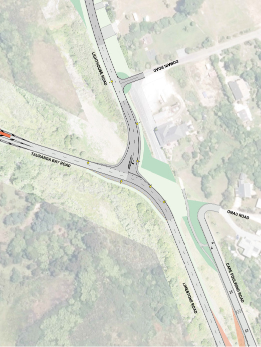
Option 2 is designed to connect Cape Foulwind Road to Limestone Road west of Larsen Street.
- A cul-de-sac head is constructed at the dead end of Cape Foulwind Road.
- Two intersections connecting Limestone and Cape Foulwind Roads will be constructed.
- Limestone Road will connect to Tauranga Bay Road and Lighthouse Road will connect as a Give Way intersection.
- Other works to realign Lighthouse Road along Limestone Road and to join Domain Road will be undertaken.
- Omau Road will transition directly on to Cape Foulwind Road
It is proposed to lower the speed limit from 100 km/hr to 80 km/h on the approaches to Omau and reduce speed to 50 km/h through Omau. Cape Foulwind Road, from Omau Road to the new cul-de-sac is proposed to be 30 km/hr to accommodate the Kawatiri Coastal Trail and a pedestrian walkway.
Council has begun discussions on potential road re-alignments, noting that this could involve some vesting of private land as road reserve and also some stopping of existing road reserve. Concept designs and a road safety audit took place in 2021/22, with preliminary design and land transfer commencing 2022/23.
Council has worked together with experts to develop a suitable solution as to how the intersection might look in the future. This design phase kicked of 2023 and involved traffic engineering, safety audits and transfer of land.
There are three parties who wish to make improvements in this area: BDC, Kawatiri Coastal Trail (KCT) which is a new cycle trail connecting Westport to Charleston and a private party who purchased all of Holcim’s former assets.
Limestone Road has been used as private haul road for Holcim for many years, but the transfer of these assets to another party who is looking to develop and sell multiple parcels of land over time has created a desire to open the road for public access. Part of Limestone Road is already Council road reserve, with the remainder being privately owned by the new party.
The main priority for Council is to improve the intersection safety, as even while it was operating as a haul road, there were reports of many near misses. Further to this, Council does not want multiple roads intersecting Tauranga Bay Road in such close proximity. The KCT is expected to attract 8,000-10,000 users per annum.
The private developers want approved access to the land at reasonable points along Cape Foulwind Road for properties to be subdivided on the sea side and full length of Limestone Road. Together, there is an opportunity for Council, the KCT and other landowners to investigate options that improve safety, simplify the intersection and provide the desired level of public access.
Where will the funding come from?
This project is jointly funded by the Buller District Council and Waka Kotahi. Council has $594,000 of funding available for this project in the 2023/24 financial year, 72% of which has been contributed by Waka Kotahi - New Zealand Transport Agency and the remaining 28% funded by Council.
Further budget has been requested from Waka Kotahi for the 2024/25 financial year in order to complete the project. This will be split in the same ratio between Council and Waka Kotahi like the first amount of funding. Should funding be approved, works are anticipated to start mid-2024.
This project is being managed by the Buller District Council and lead engineering designer Davis Ogilvie.
Which parties are involved in the project?
Buller District Council, Waka Kotahi, developers, the Kawatiri Coastal Trail and local residents are key stakeholders in this project.
What happens if Council does not get the second part of the funding from Waka Kotahi?
If Council does not receive the second part of the funding, Council will review the design and evaluate which parts of the road realignment can be progressed with the remaining funding.
What will the benefits of the road realignment be for walkers, cyclists and drivers?
The realignment will create a safer roading layout for walkers, cyclists and drivers alike. It also will create a street layout that is fit for purpose for future housing development and the anticipated increase in traffic in this area.
What impact will the project have on local property owners?
Once completed, the new street layout will create better and safer access to properties along Cape Foulwind Road/Tauranga Bay Road/Lighthouse Road.
What about the haul road, does that not belong to Holcim?
A land swap is taking place with existing adjacent Council land and the existing owner of the haul road.
Construction is planned to start in May 2024.
How do I provide feedback on the project?
For any queries regarding this project, please send an email to info@bdc.govt.nz with the subject 'Omau intersection safety improvement'
We are holding a drop-in session to discuss the proposed realignment from 4:00pm to 7:00pm at the Star Tavern, Omau on Tuesday 12 December. Join us for a beer and hear all about this exciting project.
We welcome your comments and want to hear from you. Please come along, or if you can’t make it, send your questions to info@bdc.govt.nz with the subject ‘Omau intersection safetyImprovements’
We will keep you posted about the progress of the project on our website, through our Facebook page, local media and letter drops.
We are holding a drop-in session to discuss issues and options from 4:00pm to 7:00pm at the Star Tavern, Omau on Tuesday 12 December. Join us for a beer and hear all about this exciting project.
We welcome your comments and want to hear from you. Please come along or if you can’t make it, send us your question to info@bdc.govt.nz with the subject ‘Omau intersection safety improvement’
We are also working with our engineers on the final plans. We are expecting a decision on whether the second amount of funding is approved by Waka Kotahi within 2-3 months. Once this decision is made, we will be in a position to plan for potential construction mid-2024.
Media Releases
Read our media releases covering the progress of this project.
FOR MORE INFORMATION
For any queries regarding this project, please send an email to info@bdc.govt.nz with the subject 'Omau intersection safety improvements'.

